

Creek Navigation Chartlets
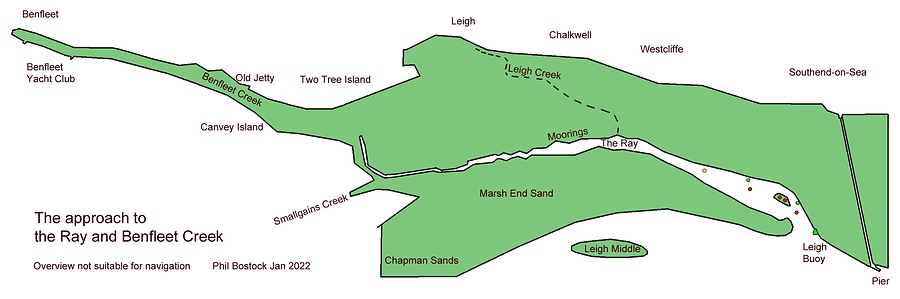

The document(s) listed below contain a number of chartlet's, plus navigational details, for the entire length of Benfleet Creek from the Leigh Buoy (Loway) at the entrance of the Ray, through to Benfleet Yacht Club. The chartlets have been produced by BYC member Phil Bostock, based on numerous physical surveys conducted by him (updated June 2024).
Both club members and visitors to the Leigh and Hadleigh Ray's, and Benfleet Creek, are welcome to use these details as an aid to their navigation, but neither Benfleet Yacht Club or the compiler take responsibility for any errors.
Please be aware that these are large files and may take a time to download on some systems.

